
State bird
Willow ptarmigan
Sources: Designation & background

The Last Frontier
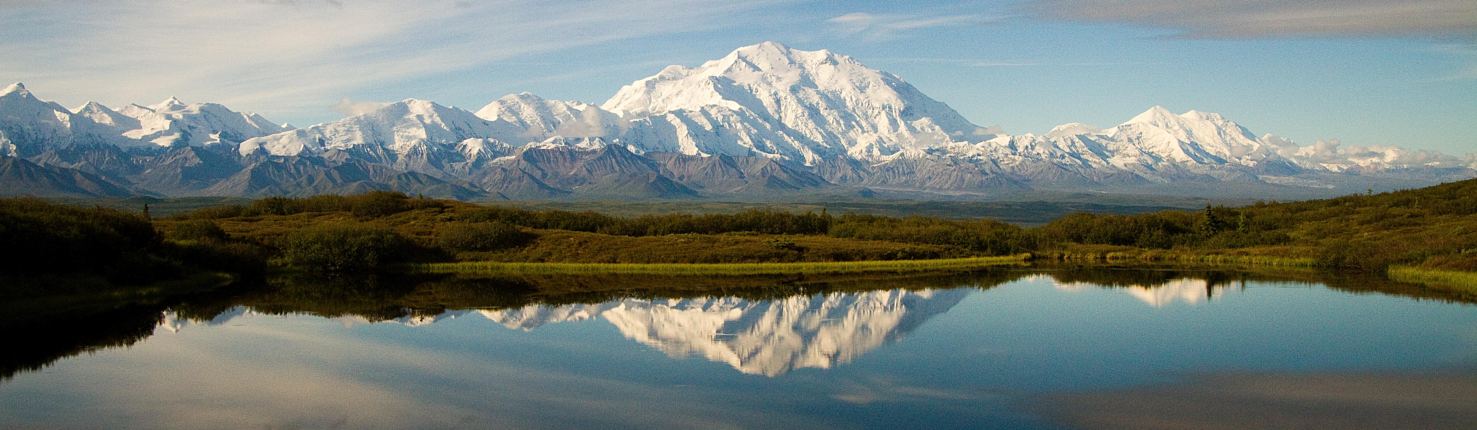
Denali National Park includes low-elevation taiga forest, alpine tundra and the high mountains of the Alaska Range.
Sources: Census · population · Census · area
Willow ptarmigan
Sources: Designation & background
Alaska’s Flag
Sources: Designation & background
Alaska borders Canada and is separated from the contiguous United States.
Denali National Park includes low-elevation taiga forest, alpine tundra and the high mountains of the Alaska Range. These habitats change with elevation, so a journey into the mountains crosses different vegetation zones rather than one continuous forest.
The total area includes 1,477,953 km² of land and 245,383 km² of water, according to Census area measurements.
Eight gold stars on a blue field form the Big Dipper and the North Star.
Sources: Census · geographic reference · Census · area measurements · National Park Service · Denali
Denali illustrates an important distinction between latitude and elevation. Alaska is far north, but conditions also change as you climb within the same region. Taiga is northern forest; alpine tundra occurs above the tree-growing zone in the mountains. A map showing only a park boundary would hide those internal habitat differences. Vegetation zones are clues to the conditions plants must survive.
Russia and the United States negotiated the transfer of Alaska in 1867. Secretary of State William Seward supported the purchase as an expansion of American influence in the Pacific. The agreed price was $7.2 million. The transfer changed which government claimed the territory; Alaska’s Indigenous peoples had lived there long before either Russian or American rule.
The purchase did not make Alaska a state. The United States administered it under several arrangements before establishing an organized territory in 1912. Statehood followed on January 3, 1959, giving Alaska voting representation in Congress and the same constitutional standing as other states.
Read more: Historical source ↗
A purchase and admission as a state are different political events. The 1867 agreement transferred Russia’s claim to the United States, but did not give Alaska the representation of a state. Decades of federal administration followed. Describing the purchase as the beginning of Alaska’s history would also erase the much longer histories of its Indigenous peoples.
Sources: Congressional Research Service · statehood · U.S. Census Bureau · historical geography · National Park Service
Alaska contains many distinct Indigenous peoples and languages. Sealaska Heritage Institute works with Tlingit, Haida, and Tsimshian cultures in Southeast Alaska; those communities should not be treated as a stand-in for every Alaska Native people.
Continue with Sealaska Heritage Institute. This is one starting point, not a complete account of the peoples connected to this land.
| Measure | Alaska | Arizona |
|---|---|---|
| Population (2025) | 737,270 | 7,623,818 |
| Land area (km²) | 1,477,953 | 294,207 |
| People per km² of land | 0.5 | 25.9 |
Arizona has more people per square kilometer of land. Population density divides population by land area. It is an average across the whole jurisdiction, not a claim that residents are evenly spread out.
Calculated from the Census population series and land-area measurements used on these pages. Rounded figures; water area is excluded. Explore Arizona.
In 2025, government and government enterprises was the largest of the broad industry groups compared here by current-dollar output. Other major groups included transportation and warehousing, mining, quarrying, and oil and gas extraction, and real estate and rental and leasing.
Total economic output was $75.0 billion in current dollars in 2025.
Share of total current-dollar GDP. These figures measure output, not employment.
Sources: BEA · annual GDP by state, SAGDP2
The industry chart measures the value of production. It does not count workers. An industry with a large share of GDP need not employ the most people or pay the highest wages. Employment and wage data would be needed to answer those questions.
July 1 resident population estimates, using the Census Bureau’s Vintage 2025 series.
Sources: U.S. Census Bureau
| Year | People |
|---|---|
| 2020 | 732,906 |
| 2021 | 734,590 |
| 2022 | 733,659 |
| 2023 | 734,654 |
| 2024 | 736,537 |
| 2025 | 737,270 |
Real GDP measures economic output adjusted for inflation. The chart uses BEA’s chained 2017 dollars.
Sources: U.S. Bureau of Economic Analysis
| Year | Millions of chained 2017 dollars |
|---|---|
| 2010 | 53,652.0 |
| 2011 | 54,045.5 |
| 2012 | 57,087.4 |
| 2013 | 54,627.6 |
| 2014 | 53,303.3 |
| 2015 | 53,681.1 |
| 2016 | 53,463.9 |
| 2017 | 53,550.9 |
| 2018 | 52,479.6 |
| 2019 | 52,377.5 |
| 2020 | 50,901.3 |
| 2021 | 51,764.0 |
| 2022 | 50,509.1 |
| 2023 | 54,183.8 |
| 2024 | 55,945.7 |
| 2025 | 57,488.0 |
Alaska’s population increased by about 0.6% between 2020 and 2025 in this series. That shows the size of the change. The chart alone cannot tell us how much came from births, deaths or migration.
Real GDP adjusts for changes in prices, so it helps compare production over time. Current-dollar GDP includes price changes. Neither measure tells us how income is distributed among residents.
Electoral votes equal the state’s U.S. House seats plus its two U.S. Senate seats. These allocations apply to the 2024 and 2028 presidential elections. The state elects one U.S. representative at large, serving the whole state.
Use the explanations and data on this page to answer ten questions. Hints and links to the relevant sections are available throughout.
Your place in the quiz and best full-quiz score are saved on this device when browser storage is available.
Want to practice recognizing states? Try the mixed-state map quiz.
Narrative and quiz updated 5 October 2026. Statistical data prepared 27 September 2026. Population: Census Bureau Vintage 2025, July 1 estimates for 2020–2025. Real GDP: BEA annual state accounts, SAGDP9, millions of chained 2017 dollars; industry shares: SAGDP2, current dollars. Data downloaded 27 September 2026. Area measurements include land and water.
Sources: Census · population estimates · BEA · state GDP · Census · area measurements · Natural Earth · map data
The capital clock shows current local time. Statistical figures are dated estimates and may be revised.
Updated 29 October 2026. Statistics retain the dated series shown in the charts; these are not live figures. Sources are linked beside each topic.