
State bird
Purple finch
Sources: Designation & background

The Granite State
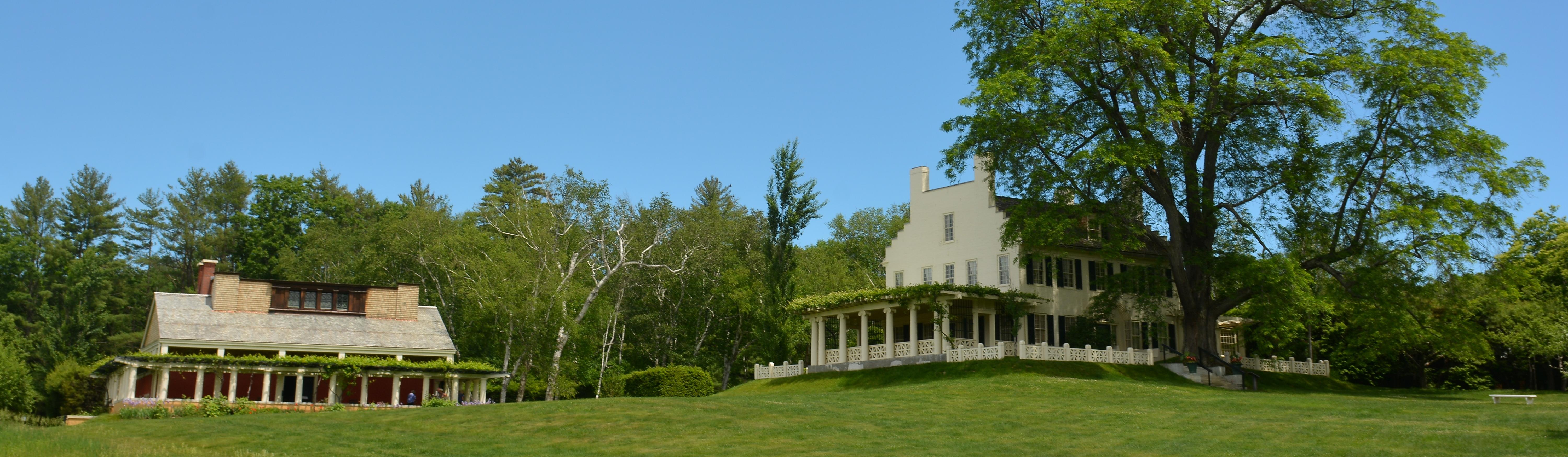
Saint-Gaudens National Historical Park preserves the Cornish home, studios, gardens and sculpture of Augustus Saint-Gaudens.
Sources: Census · population · Census · area
Purple finch
Sources: Designation & background
Old New Hampshire
Sources: Designation & background
Pumpkin
Sources: Designation & background
Neighboring states: Maine, Massachusetts, Vermont.
Saint-Gaudens National Historical Park preserves the Cornish home, studios, gardens and sculpture of Augustus Saint-Gaudens. The site connects New Hampshire’s rural landscape with the creation of nationally known public art.
The total area includes 23,187 km² of land and 1,027 km² of water, according to Census area measurements.
The state seal inside a wreath on a blue field; a sailing ship appears in the seal.
Sources: Census · geographic reference · Census · area measurements · National Park Service · Saint-Gaudens
Saint-Gaudens National Historical Park preserves a home, studios, gardens, and art. Its significance lies partly in how a working place supported the creation of sculpture displayed elsewhere. A rural site can have national connections without containing a battlefield or a capital. Places of production help explain where public culture comes from.
The proposed U.S. Constitution required approval by nine states before the new system could take effect among the states that ratified it. Supporters argued for a stronger federal government; opponents worried that its powers were too broad and that individual rights needed clearer protection.
On June 21, 1788, New Hampshire became the ninth state to ratify. Its vote met the constitutional threshold, although debates continued in other states. The new federal government began operating in 1789. New Hampshire’s importance lies in completing the required number of approvals, not in being the last state to join the original group.
Read more: Historical source ↗
The Constitution specified ratification by nine states for it to take effect among those states. New Hampshire was the ninth to ratify. Being the ninth mattered because of that threshold, not because the other states were unimportant. Counting an event without explaining the rule that makes the count significant leaves out the reason it mattered.
Sources: Congressional Research Service · statehood · U.S. Census Bureau · historical geography · National Park Service
The history of the Saint-Gaudens site belongs within a longer history of the region. Its historical resources are a starting point for examining the people and uses of the land beyond the sculptor’s own lifetime.
Continue with Saint-Gaudens National Historical Park. This is one starting point, not a complete account of the peoples connected to this land.
| Measure | New Hampshire | Maine |
|---|---|---|
| Population (2025) | 1,415,342 | 1,414,874 |
| Land area (km²) | 23,187 | 79,883 |
| People per km² of land | 61.0 | 17.7 |
New Hampshire has more people per square kilometer of land. Population density divides population by land area. It is an average across the whole jurisdiction, not a claim that residents are evenly spread out.
Calculated from the Census population series and land-area measurements used on these pages. Rounded figures; water area is excluded. Explore Maine.
In 2025, professional and business services was the largest of the broad industry groups compared here by current-dollar output. Other major groups included real estate and rental and leasing, educational services, health care, and social assistance, and government and government enterprises.
Total economic output was $125.5 billion in current dollars in 2025.
Share of total current-dollar GDP. These figures measure output, not employment.
Sources: BEA · annual GDP by state, SAGDP2
The industry chart measures the value of production. It does not count workers. An industry with a large share of GDP need not employ the most people or pay the highest wages. Employment and wage data would be needed to answer those questions.
July 1 resident population estimates, using the Census Bureau’s Vintage 2025 series.
Sources: U.S. Census Bureau
| Year | People |
|---|---|
| 2020 | 1,378,752 |
| 2021 | 1,387,907 |
| 2022 | 1,396,647 |
| 2023 | 1,401,530 |
| 2024 | 1,408,518 |
| 2025 | 1,415,342 |
Real GDP measures economic output adjusted for inflation. The chart uses BEA’s chained 2017 dollars.
Sources: U.S. Bureau of Economic Analysis
| Year | Millions of chained 2017 dollars |
|---|---|
| 2010 | 72,950.4 |
| 2011 | 73,465.0 |
| 2012 | 74,082.8 |
| 2013 | 75,503.4 |
| 2014 | 76,836.2 |
| 2015 | 79,319.3 |
| 2016 | 80,736.1 |
| 2017 | 81,179.6 |
| 2018 | 82,269.5 |
| 2019 | 84,438.2 |
| 2020 | 83,682.9 |
| 2021 | 90,296.7 |
| 2022 | 91,702.1 |
| 2023 | 93,645.8 |
| 2024 | 94,926.0 |
| 2025 | 96,874.8 |
New Hampshire’s population increased by about 2.7% between 2020 and 2025 in this series. That shows the size of the change. The chart alone cannot tell us how much came from births, deaths or migration.
Real GDP adjusts for changes in prices, so it helps compare production over time. Current-dollar GDP includes price changes. Neither measure tells us how income is distributed among residents.
Electoral votes equal the state’s U.S. House seats plus its two U.S. Senate seats. These allocations apply to the 2024 and 2028 presidential elections.
Use the explanations and data on this page to answer ten questions. Hints and links to the relevant sections are available throughout.
Your place in the quiz and best full-quiz score are saved on this device when browser storage is available.
Want to practice recognizing states? Try the mixed-state map quiz.
Narrative and quiz updated 5 October 2026. Statistical data prepared 27 September 2026. Population: Census Bureau Vintage 2025, July 1 estimates for 2020–2025. Real GDP: BEA annual state accounts, SAGDP9, millions of chained 2017 dollars; industry shares: SAGDP2, current dollars. Data downloaded 27 September 2026. Area measurements include land and water.
Sources: Census · population estimates · BEA · state GDP · Census · area measurements · Natural Earth · map data
The capital clock shows current local time. Statistical figures are dated estimates and may be revised.
Updated 29 October 2026. Statistics retain the dated series shown in the charts; these are not live figures. Sources are linked beside each topic.