
State bird
Hermit thrush
Sources: Designation & background

The Green Mountain State
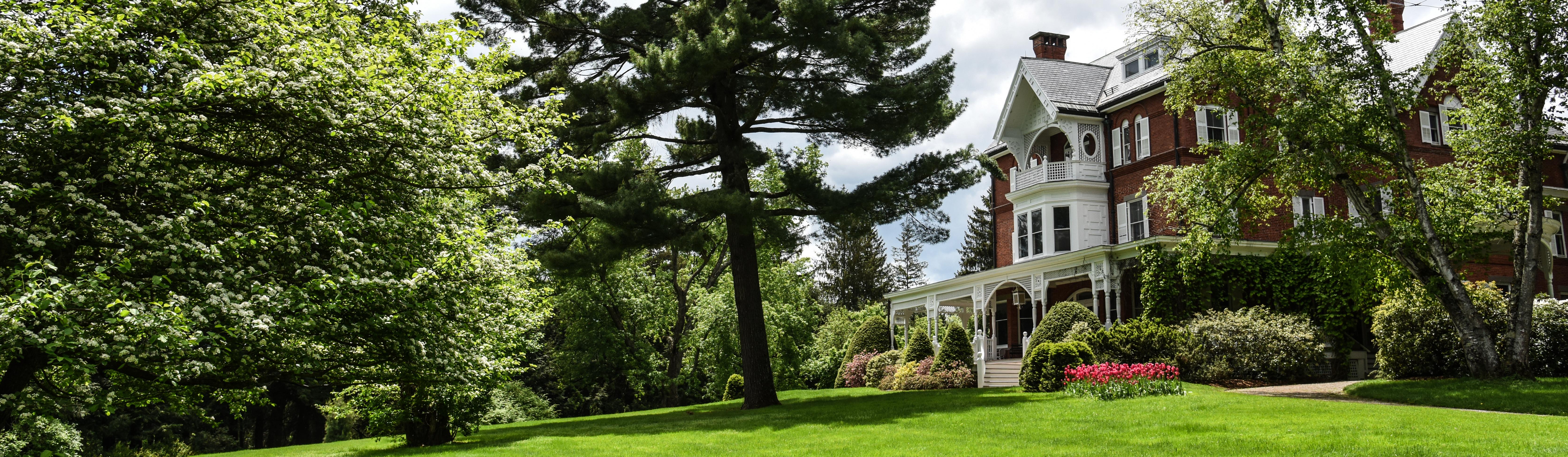
Marsh-Billings-Rockefeller National Historical Park in Woodstock preserves a managed forest and the history of conservation.
Sources: Census · population · Census · area
Hermit thrush
Sources: Designation & background
These Green Mountains
Sources: Designation & background
Apple pie
Sources: Designation & background
Neighboring states: Massachusetts, New Hampshire, New York.
Marsh-Billings-Rockefeller National Historical Park in Woodstock preserves a managed forest and the history of conservation. It shows how people can study and manage a working landscape over generations, rather than treating conservation as the absence of all human activity.
The total area includes 23,871 km² of land and 1,035 km² of water, according to Census area measurements.
The state coat of arms on a blue field, showing a pine tree, a cow and sheaves of grain.
Sources: Census · geographic reference · Census · area measurements · National Park Service · Marsh - Billings - Rockefeller
A managed forest is a landscape shaped by repeated decisions about trees, access, and long-term use. Marsh-Billings-Rockefeller connects conservation history with that continuing work. Conservation can involve active management and learning over generations, not only excluding people. The visible forest records both natural growth and human choices.
Both New Hampshire and New York claimed authority over land that became Vermont. Settlers who held New Hampshire grants resisted New York’s competing claims, so the dispute affected people’s homes and property as well as colonial boundaries.
Vermont declared its own government in 1777 and adopted a constitution, but New York’s claim complicated admission to the United States. After the dispute was settled, Vermont entered the Union in 1791 as the first state added after the original thirteen. Its period of separate government explains why its history does not follow the usual territorial path.
Read more: Historical source ↗
Vermont’s history involved competing land claims and a dispute with New York. It operated separately before joining the Union in 1791 after resolving the dispute. A present-day boundary can make statehood look straightforward, but earlier residents faced overlapping claims to authority. Settling those claims was part of establishing the state.
Sources: Congressional Research Service · statehood · U.S. Census Bureau · historical geography · National Park Service
The Vermont Commission on Native American Affairs provides information about the state’s contemporary Native affairs framework. State recognition and federal recognition are different processes and should not be treated as interchangeable labels.
Continue with Vermont Commission on Native American Affairs. This is one starting point, not a complete account of the peoples connected to this land.
| Measure | Vermont | Massachusetts |
|---|---|---|
| Population (2025) | 644,663 | 7,154,084 |
| Land area (km²) | 23,871 | 20,202 |
| People per km² of land | 27.0 | 354.1 |
Massachusetts has more people per square kilometer of land. Population density divides population by land area. It is an average across the whole jurisdiction, not a claim that residents are evenly spread out.
Calculated from the Census population series and land-area measurements used on these pages. Rounded figures; water area is excluded. Explore Massachusetts.
In 2025, real estate and rental and leasing was the largest of the broad industry groups compared here by current-dollar output. Other major groups included educational services, health care, and social assistance, government and government enterprises, and professional and business services.
Total economic output was $48.4 billion in current dollars in 2025.
Share of total current-dollar GDP. These figures measure output, not employment.
Sources: BEA · annual GDP by state, SAGDP2
The industry chart measures the value of production. It does not count workers. An industry with a large share of GDP need not employ the most people or pay the highest wages. Employment and wage data would be needed to answer those questions.
July 1 resident population estimates, using the Census Bureau’s Vintage 2025 series.
Sources: U.S. Census Bureau
| Year | People |
|---|---|
| 2020 | 642,965 |
| 2021 | 647,238 |
| 2022 | 647,614 |
| 2023 | 647,722 |
| 2024 | 646,521 |
| 2025 | 644,663 |
Real GDP measures economic output adjusted for inflation. The chart uses BEA’s chained 2017 dollars.
Sources: U.S. Bureau of Economic Analysis
| Year | Millions of chained 2017 dollars |
|---|---|
| 2010 | 30,890.6 |
| 2011 | 31,663.6 |
| 2012 | 31,898.1 |
| 2013 | 31,494.6 |
| 2014 | 31,847.7 |
| 2015 | 32,042.9 |
| 2016 | 32,312.7 |
| 2017 | 32,589.2 |
| 2018 | 32,827.8 |
| 2019 | 33,339.4 |
| 2020 | 32,408.7 |
| 2021 | 33,584.3 |
| 2022 | 34,915.9 |
| 2023 | 35,499.4 |
| 2024 | 36,398.9 |
| 2025 | 36,908.2 |
Vermont’s population increased by about 0.3% between 2020 and 2025 in this series. That shows the size of the change. The chart alone cannot tell us how much came from births, deaths or migration.
Real GDP adjusts for changes in prices, so it helps compare production over time. Current-dollar GDP includes price changes. Neither measure tells us how income is distributed among residents.
Electoral votes equal the state’s U.S. House seats plus its two U.S. Senate seats. These allocations apply to the 2024 and 2028 presidential elections. The state elects one U.S. representative at large, serving the whole state.
Use the explanations and data on this page to answer ten questions. Hints and links to the relevant sections are available throughout.
Your place in the quiz and best full-quiz score are saved on this device when browser storage is available.
Want to practice recognizing states? Try the mixed-state map quiz.
Narrative and quiz updated 5 October 2026. Statistical data prepared 27 September 2026. Population: Census Bureau Vintage 2025, July 1 estimates for 2020–2025. Real GDP: BEA annual state accounts, SAGDP9, millions of chained 2017 dollars; industry shares: SAGDP2, current dollars. Data downloaded 27 September 2026. Area measurements include land and water.
Sources: Census · population estimates · BEA · state GDP · Census · area measurements · Natural Earth · map data
The capital clock shows current local time. Statistical figures are dated estimates and may be revised.
Updated 29 October 2026. Statistics retain the dated series shown in the charts; these are not live figures. Sources are linked beside each topic.