
State bird
Northern mockingbird
Sources: Designation & background

The Volunteer State
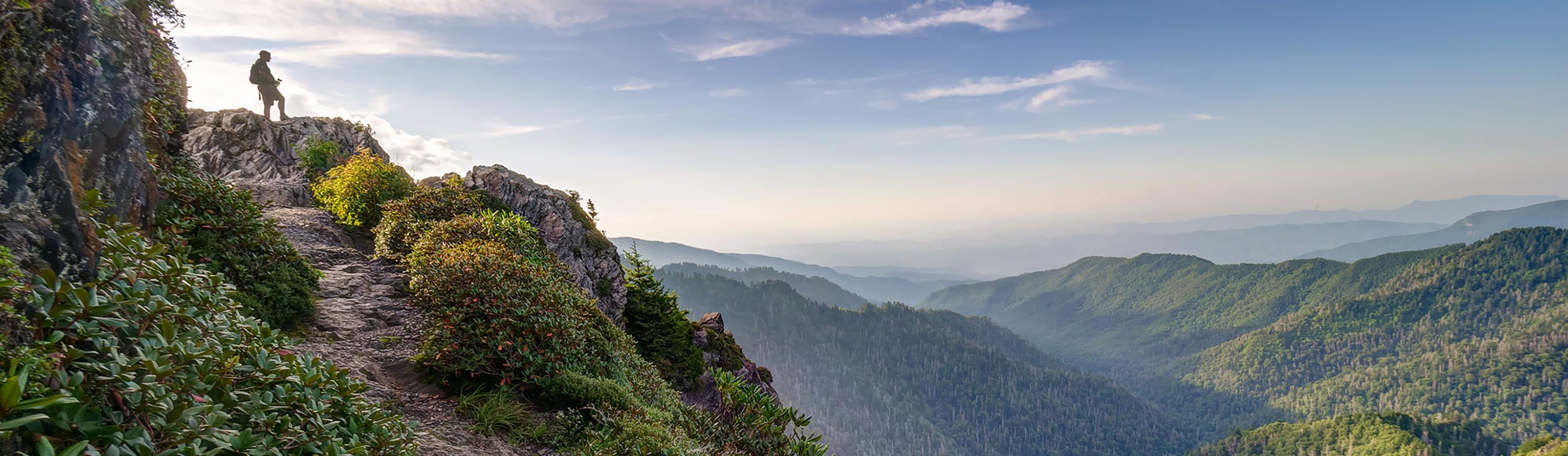
Great Smoky Mountains National Park spans Tennessee and North Carolina.
Sources: Census · population · Census · area
Northern mockingbird
Sources: Designation & background
Tennessee Waltz; Rocky Top
Sources: Designation & background
Neighboring states: Alabama, Arkansas, Georgia, Kentucky, Mississippi, Missouri, North Carolina, Virginia.
Great Smoky Mountains National Park spans Tennessee and North Carolina. Forested ridges and changes in elevation support a wide range of plants and animals. Historic buildings also preserve evidence of mountain communities.
The total area includes 106,798 km² of land and 2,355 km² of water, according to Census area measurements.
Three white stars in a blue circle on red, with blue and white stripes at the fly edge.
Sources: Census · geographic reference · Census · area measurements · National Park Service · Great Smoky Mountains
The Great Smoky Mountains span Tennessee and North Carolina. Elevation creates different conditions across forested ridges, helping support varied habitats. Historic buildings add evidence of mountain communities. Crossing a state line inside this mountain system changes political jurisdiction, but does not make the physical landscape start over.
During the Great Depression, parts of the Tennessee Valley faced poverty, flooding and limited access to electricity. Congress created the Tennessee Valley Authority in 1933 to address several related problems across a river basin that extended beyond one state.
TVA’s dams were intended to control floods, improve navigation and generate affordable electric power. Electricity supported homes, farms and industry, while coordinated river management changed how the valley developed. The project is an example of federal economic planning on a regional scale, rather than a program confined to Tennessee’s state boundaries.
Read more: Historical source ↗
The Tennessee Valley Authority combined goals such as flood control, electricity generation, and regional development. A dam could serve more than one purpose. Projects also changed the lives of people whose homes or land were affected. Evaluating a public project requires asking who benefited, what problems it addressed, and what costs it imposed.
Sources: Congressional Research Service · statehood · U.S. Census Bureau · historical geography · National Park Service
Cherokee history spans the southern Appalachians, including Tennessee, while the Eastern Band’s governmental center is in North Carolina. A shared mountain region and histories of displacement do not fit neatly inside present-day state borders.
Continue with Eastern Band of Cherokee Indians. This is one starting point, not a complete account of the peoples connected to this land.
| Measure | Tennessee | Alabama |
|---|---|---|
| Population (2025) | 7,315,076 | 5,193,088 |
| Land area (km²) | 106,798 | 131,171 |
| People per km² of land | 68.5 | 39.6 |
Tennessee has more people per square kilometer of land. Population density divides population by land area. It is an average across the whole jurisdiction, not a claim that residents are evenly spread out.
Calculated from the Census population series and land-area measurements used on these pages. Rounded figures; water area is excluded. Explore Alabama.
In 2025, real estate and rental and leasing was the largest of the broad industry groups compared here by current-dollar output. Other major groups included manufacturing, professional and business services, and educational services, health care, and social assistance.
Total economic output was $589.8 billion in current dollars in 2025.
Share of total current-dollar GDP. These figures measure output, not employment.
Sources: BEA · annual GDP by state, SAGDP2
The industry chart measures the value of production. It does not count workers. An industry with a large share of GDP need not employ the most people or pay the highest wages. Employment and wage data would be needed to answer those questions.
July 1 resident population estimates, using the Census Bureau’s Vintage 2025 series.
Sources: U.S. Census Bureau
| Year | People |
|---|---|
| 2020 | 6,927,736 |
| 2021 | 6,966,687 |
| 2022 | 7,063,325 |
| 2023 | 7,153,029 |
| 2024 | 7,251,291 |
| 2025 | 7,315,076 |
Real GDP measures economic output adjusted for inflation. The chart uses BEA’s chained 2017 dollars.
Sources: U.S. Bureau of Economic Analysis
| Year | Millions of chained 2017 dollars |
|---|---|
| 2010 | 292,687.0 |
| 2011 | 301,508.9 |
| 2012 | 311,754.2 |
| 2013 | 318,347.9 |
| 2014 | 323,879.6 |
| 2015 | 335,461.1 |
| 2016 | 343,544.9 |
| 2017 | 355,417.5 |
| 2018 | 362,363.7 |
| 2019 | 370,197.4 |
| 2020 | 368,057.0 |
| 2021 | 401,673.7 |
| 2022 | 415,451.6 |
| 2023 | 428,276.1 |
| 2024 | 440,200.2 |
| 2025 | 449,356.6 |
Tennessee’s population increased by about 5.6% between 2020 and 2025 in this series. That shows the size of the change. The chart alone cannot tell us how much came from births, deaths or migration.
Real GDP adjusts for changes in prices, so it helps compare production over time. Current-dollar GDP includes price changes. Neither measure tells us how income is distributed among residents.
Electoral votes equal the state’s U.S. House seats plus its two U.S. Senate seats. These allocations apply to the 2024 and 2028 presidential elections.
Use the explanations and data on this page to answer ten questions. Hints and links to the relevant sections are available throughout.
Your place in the quiz and best full-quiz score are saved on this device when browser storage is available.
Want to practice recognizing states? Try the mixed-state map quiz.
Narrative and quiz updated 5 October 2026. Statistical data prepared 27 September 2026. Population: Census Bureau Vintage 2025, July 1 estimates for 2020–2025. Real GDP: BEA annual state accounts, SAGDP9, millions of chained 2017 dollars; industry shares: SAGDP2, current dollars. Data downloaded 27 September 2026. Area measurements include land and water.
Sources: Census · population estimates · BEA · state GDP · Census · area measurements · Natural Earth · map data
The capital clock shows current local time. Statistical figures are dated estimates and may be revised.
Updated 29 October 2026. Statistics retain the dated series shown in the charts; these are not live figures. Sources are linked beside each topic.